Description
Highlights
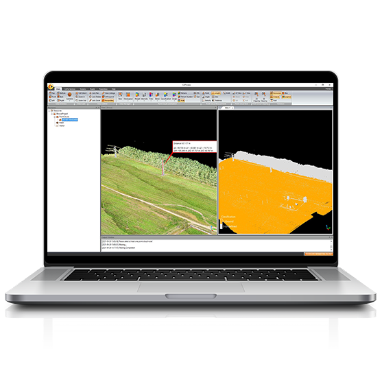
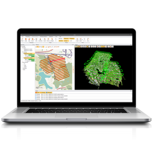
CoProcess, developed by CHCNAV, is a powerful software solution tailored to the post-processing of massive point cloud data. It seamlessly processes field-captured LiDAR data into a variety of multi-format deliverables. With features such as point cloud management, measurement tools, and advanced visualization, CoProcess is an essential tool for professionals in urban planning, infrastructure development, and more.
Extract road features automatically and manually and export them in SHP or DXF formats for seamless integration with AutoCAD and ArcGIS. CoProcess also supports the extraction of building contours, doors, and windows.
Classify point cloud data into different categories such as ground, vegetation, buildings, roads, and power lines using CHCNAV’s state-of-the-art algorithms. This classification allows for efficient data management and improved analysis.
Calculate volumes from point clouds using the grid method and export results in DXF format. Analyze volume differences between successive LiDAR data sets, providing detailed reports for informed decision-making.


Reviews
There are no reviews yet.